Landfolio
Landfolio is a commercial-off-the-shelf (COTS) land management solution which enables customers around the globe to manage compliance and extract value from their land assets.
As the only truly global land management system on the market today, Landfolio allows users to manage their often complex land obligations in a simple to use, browser environment, bringing efficiency, transparency and governance to your organization’s land team.
Landfolio eSuite
Landfolio eSuite is Spatial Dimension’s mining cadastre platform for governments, designed to modernise compliance management in the extractive industry. Built on decades of expertise, Landfolio eSuite provides government agencies, license holders, and stakeholders with a comprehensive suite of tools for managing exploration and mining licenses, ensuring transparency, accountability, and compliance.
With modules addressing everything from license lifecycle management to public engagement, Landfolio eSuite offers a secure, configurable, and user-friendly solution that adapts to the legislative and operational requirements of jurisdictions worldwide.
Major Functional Areas
-
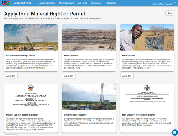
License Lifecycle Management:
Manage the complete lifecycle of mining licenses, from application to renewal, transfer, and closure.
-
Spatial Mapping and Validation:
Visualise mining tenure data through interactive maps and validate spatial information in real time.
-
Stakeholder Engagement:
Facilitate public participation and communication, ensuring transparent governance processes.
-
Compliance and Reporting:
Track and fulfil reporting obligations, including production data and royalties.
-
Inter-Agency Collaboration:
Integrate external approvals and inputs from third parties, such as environmental agencies.
-
Financial Management:
Streamline payments via gateways or government billing systems, with reconciliation and audit capabilities.
-
Security and Audit:
Ensure enterprise-level security, role-based access, and comprehensive auditing to safeguard data integrity.
Integrated GIS
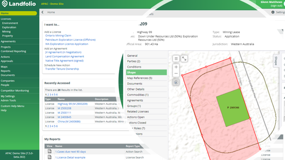
One of the most powerful features of Landfolio is the ability to view and manage associated spatial data attributes side-by side with your business data, in a fully integrated environment. Landfolio leverages ESRI’s ArcGIS Server technology to provide users with a seamless user experience when viewing and editing license and land boundaries, agreements, projects and more.
Spatial Validations, overlap detection, and recording survey details are just some of the advanced features available in Landfolio.
The ability of Landfolio to capture and process both spatial and non-spatial data is the key factor for Mineral Resources Authority and well-fitting with the requirements of the Mining Act.
- Papua New Guinea Mineral Resource Authority
Dashboards & Reports
Landfolio provides users with a set of easy to use, configurable reports to output important information across all key data types including Land, Lease and Licenses; Contracts and Agreements; Actions and Approvals; People and Companies; and also System Audits.
Additionally, the Spatial Dimension team is able to develop client specific reports or dashboards leveraging PowerBI or SSRS, to suit your organization’s unique requirements.
Document Management
The Landfolio solution includes document management functionality as part of the core application. Any type of file or document may be loaded into Landfolio including key metadata fields, and linked to one or more system objects.
In addition to the loading of documents into the Landfolio database, links to external document repositories or file systems are also supported, such as SharePoint.
Workflows and Business Rules
Landfolio includes a comprehensive workflow engine designed to manage customer business processes ensuring compliance with jurisdictional regulations and internal internal processes.
The system workflows are configured via client-side wizards and forms which allow Admin users to easily update the configuration should regulations or business processes change, without the need for service packs or costly software development.
Workflows can be configured to manage all processes across the lifecycle of a license, right, or agreement, with flexibility to assign roles, send notifications, capture checklist items, or manage digital approvals.
API and Integrations
Landfolio has an API and a suite of tools geared to support integrations with a variety of third-party applications, in support of current best practice enterprise architectures.